Welcome to the New and Improved UWRAP
We Received a Facelift, Refreshed the Wildfire Risk Assessment Data, and Added New Features! Learn More Below.
Welcome to Your Resource for Wildfire Risk Information
Explore the Site or Learn More about Our Applications and Tools
About
Wildfires continue to threaten people and property across Utah. As the state’s population grows, our communities are rapidly expanding into the wildland urban interface (WUI). Effects from long-term drought and high levels of hazardous fuels accumulation, across the state, present major concerns for these communities. Fire has long since been an important part of our ecosystem and adapting our communities to live with fire is imperative as we continue to expand into wildland areas.
Our goal is to empower homeowners, communities, fire departments, and municipalities to act in reducing their vulnerability to wildfire by giving them the necessary tools to identify and understand their wildfire risk.
The Utah Wildfire Risk Assessment Portal (UWRAP) is a free, easy-to-use website with information, data, and resources to help you understand and identify your wildfire risk.
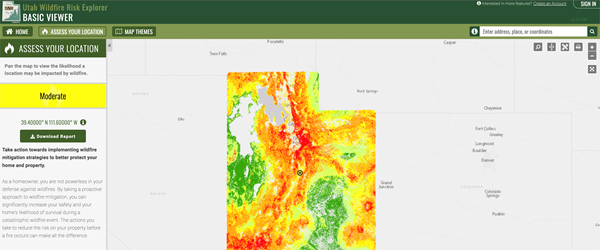
Curious About Your Risk?
Enter your address or zoom into a location on the map to get an assessment of wildfire risk for that location. For more detailed information on the assessment or wildfire risk at a specific location, go to the Risk Explorer.
Tools
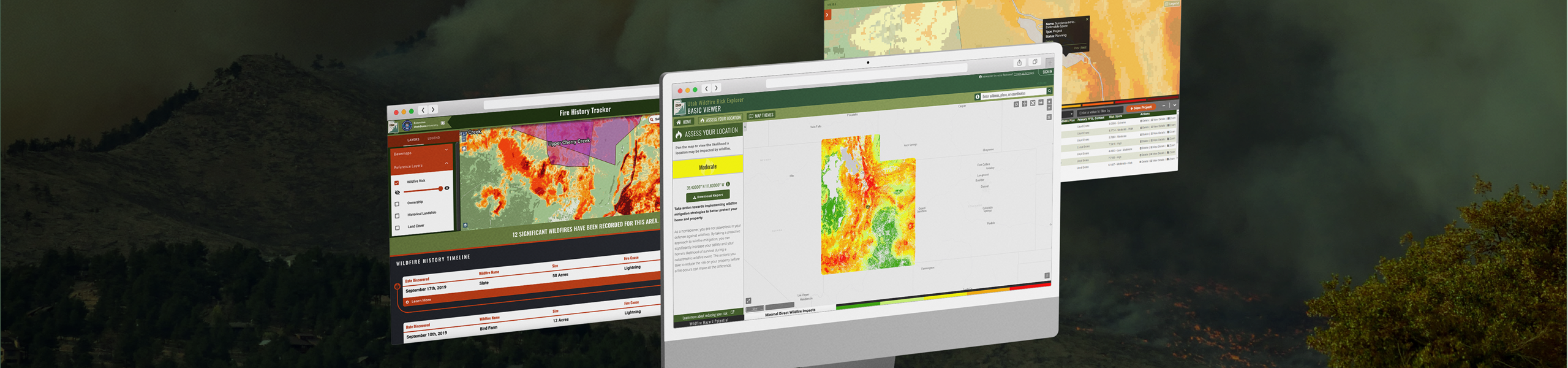
Utah Wildfire Risk Explorer
The Utah Wildfire Risk Explorer (known as the “Risk Explorer”) is the primary mechanism for Utah Forestry, Fire, and State Lands to deploy wildfire risk information and create awareness about wildfire issues across the state. This application is tailored to support specific workflow and information requirements for the public, local community groups, private landowners, government officials, hazard-mitigation planners, and wildland fire managers. The application also provides the baseline information needed to support mitigation and prevention efforts across the state.
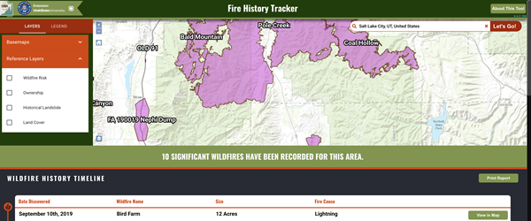
Fire History Tracker
The Utah Fire History Tracker is an interactive map that allows the user to better understand the nature of past wildfire occurrences in the state. It is designed to be the authoritative source for mapped wildfire events in Utah. The tool enables the user to explore the history of wildfire in their chosen area of interest, and to generate a report with a timeline and map of historic wildfires in that area. The Fire History Tracker displays all wildfires over 10 acres, dating back to 2017. The records include the date and point of ignition, area burned, and structures threatened/destroyed.
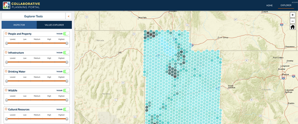
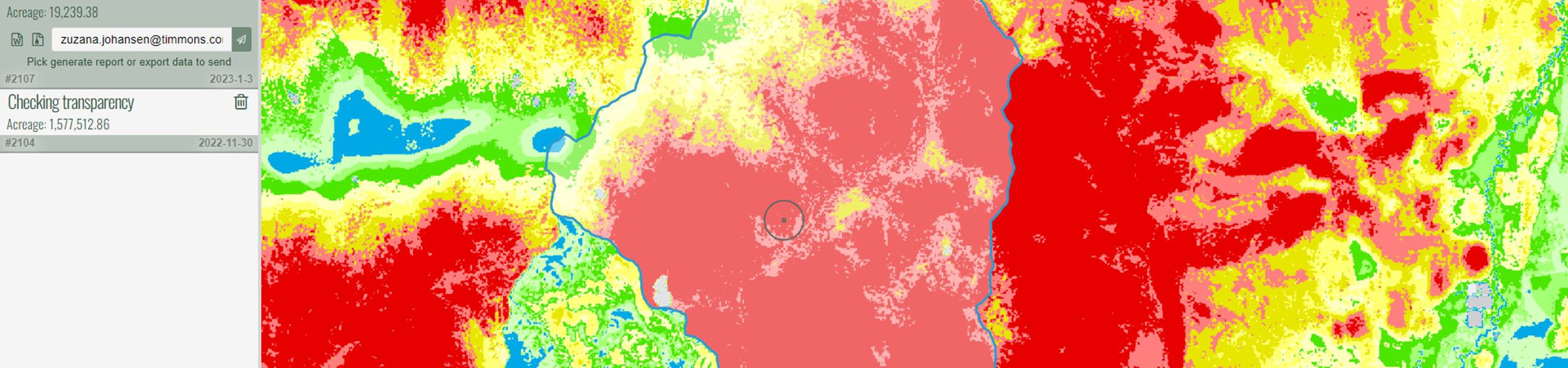
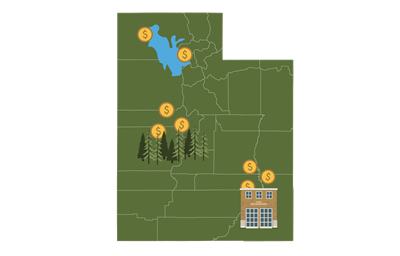
Values Explorer
The Values Explorer is a planning tool designed to aid in prioritizing hazardous fuel reduction and wildfire mitigation projects by showing wildfire hazard potential (WHP) and allowing the user to view the density and distribution of highly valued resources and assets (HVRAs) in the user’s area of interest.
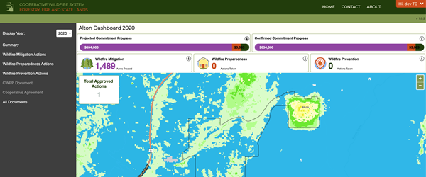
Cooperative Wildfire System (CWS)
Utah’s Cooperative Wildfire System (CWS) is based on the simple principle of risk reduction wherein the state will pay the costs of large and extended attack wildland fire (“catastrophic fires”) in exchange for local government providing initial attack and implementing prevention, preparedness and mitigation actions that are proven to reduce their risk and costs of wildland fire in the long run. The CWS tool is used by participating entities (PEs) to track mitigation, preparedness, and prevention actions and report on their participation commitment.
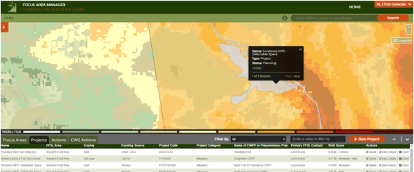
Focus Area Manager
The Focus Area Manager allows users to create focus areas and delineate project areas and activity boundaries for wildfire mitigation efforts. Focus areas are scored using Wildfire Risk/Threat Data to assist the state in making informed decisions. The new module also allows FFSL to better track where projects are implemented on the landscape. This tool is used by FFSL staff.
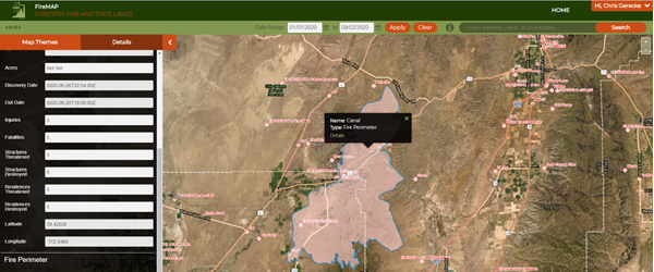
FireMAP
FireMAP allows Forestry, Fire, and State Lands (FFSL), Fire Business staff and GIS analysts to easily delineate wildfire perimeter data and associate polygons to ignition incidents pulled from the Integrated Reporting of Wildland-Fire Information (IRWIN). This tool is used by FFSL staff.


Interested in the state wide Wildfire Risk Explorer data? Download it here.
What’s New in Utah WRAP
We've made new changes! See all the new additions and upgrades that we've added to the Utah WRAP:
- Updated Wildfire Risk Assessment Data Layers
- New UWRAP landing page
- Easily accessible Homeowner Resources
- Simplified “What’s Your Risk” Tool for Homeowners
- Easy access to Tools
- Redesigned Contact Us section
- Rebranded Wildfire Risk Explorer Tool
- Renamed Viewers (Public Viewer is now the Basic Viewer and the Professional Viewer is now the Advanced Viewer)
- Learn More modal comparing the Basic vs. Advanced Viewers
- Streamlined sign-in workflow
- Ability to sign in to the Advanced Viewer directly from the Basic Viewer
- Redesigned Create Account page
- New header layouts for the Risk Explorer
- Access to HVRA data in the new Values Explorer application
Contact Us
Required fields are marked with an asterisk (*).